Dealer Network Now Open Across North America Find Your Local Dealer β†’

Weyerhaeuser Land Access & Recreation Permit Guide

Everything you need to know about obtaining recreation permits, understanding permit maps, and accessing Weyerhaeuser-managed timberlands for outdoor activities.

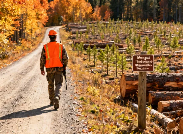
Why Permits Matter on Managed Timberlands

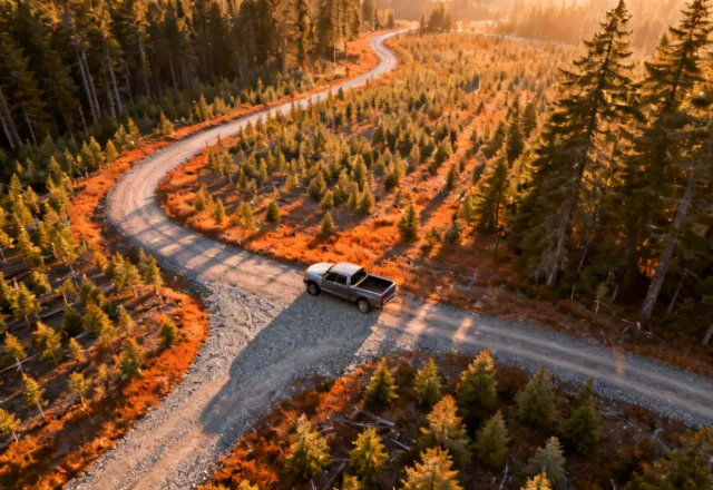
Weyerhaeuser manages millions of acres of productive forest across the Pacific Northwest, South, and Mountain regions of North America. These lands are actively harvested and regenerated on a continuous basis β€” which means road conditions, gate access, and safety rules change seasonally.

Recreation permits exist to coordinate public access with active logging operations, protect wildlife habitats during sensitive periods, and ensure visitor safety on roads designed for industrial use. Understanding the permit system before heading out protects you and helps preserve access for everyone.

Weyerhaeuser managed timberland with forest road access

Types of Permits Available

Weyerhaeuser offers several permit categories to accommodate different uses of managed timberlands.

πŸ•οΈ

Recreation Permit

General access for hiking, hunting, camping, and nature photography on designated tracts. Subject to seasonal road closures.

  • βœ“ Annual or seasonal term
  • βœ“ Vehicle gate pass included
  • βœ“ Tract-specific map provided
🎣

Fishing Access Permit

Stream and lake access on tracts with significant fishery resources. Requires compliance with state fishing regulations in addition to Weyerhaeuser rules.

  • βœ“ Specific water body access
  • βœ“ Stream buffer rules apply
  • βœ“ State fishing license required
🌲

Christmas Tree Permit

Seasonal permit for cutting a personal-use Christmas tree from regenerating stand areas. Available in select regions from late November.

  • βœ“ One tree per permit
  • βœ“ Designated cutting areas only
  • βœ“ Tool size restrictions apply
πŸ—ΊοΈ

Special Use Permit

For organized groups, commercial recreation operators, research activities, or uses not covered by standard recreation permits. Reviewed case by case.

  • βœ“ Application review required
  • βœ“ Insurance may be required
  • βœ“ Contact regional office

Understanding the Permit Map

Weyerhaeuser's permit map identifies which tracts require permits, which roads are currently open or gated, and what activities are permitted in each zone. Maps are updated quarterly as harvest operations change.

Map Legend
  • Open permit area β€” current season
  • Closed β€” active harvest operation
  • Seasonal closure β€” check before visiting
  • No public access β€” private operations

Road conditions on logging roads change rapidly. Always confirm current access status with your regional office before visiting, even with a valid permit.

πŸ—ΊοΈ

Interactive permit map β€” displays open areas, seasonal closures, and road access status by region

Request Permit Map PDF

How to Apply for a Permit

1
Identify Your Region

Locate the Weyerhaeuser tract you want to access on the permit map and note the managing regional office.

2
Submit Application

Complete the permit request form online or contact the regional office directly. Include intended use and dates.

3
Review & Processing

Standard recreation permits are typically processed within 5 business days. Special use permits require additional review.

4
Access & Compliance

Carry your permit and follow all posted rules. Yield to logging trucks and equipment β€” active operations have right of way.

Rules & Responsibilities

Permit holders are responsible for reading and complying with all posted rules for the tract. Key requirements include:

Safety on Logging Roads

Travel speeds are limited to 25 mph. Use headlights at all times. Logging trucks and equipment have unconditional right of way. Never park on road curves or near active loading areas.

Leave No Trace

Pack out all waste. No fires except in approved fire rings during designated seasons. Camping is allowed only in designated sites on applicable permits.

Wildlife Corridors

Certain areas are seasonally closed to protect nesting raptor pairs, deer fawning areas, and elk calving zones. These closures are marked on the permit map and take precedence over general recreation access.

Responsible recreation on Weyerhaeuser managed timberland